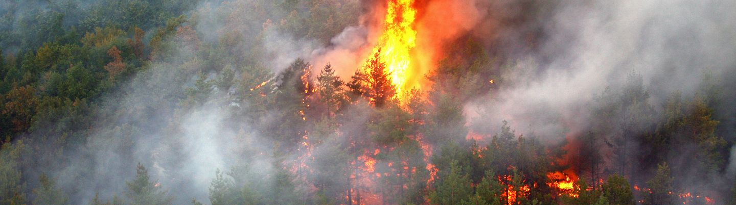
In recent years, the Alps and other mountainous regions in Europe became increasingly affected by forest fires. Fires are a major threat for mountain forests and their services for economy, tourism, health, water quality and natural hazards protection. Current forecasts of forest fire danger have too coarse resolutions, are solely based on weather information and do not consider actual surface moisture and vegetation conditions. CONFIRM aims to integrate high-resolution Copernicus Sentinel-1 and 2 observations on surface moisture and vegetation conditions with LiDAR data, fire weather forecasts, socioeconomic information, topographic data and a forest fire database to develop a novel, high-resolution and satellite-supported integrated forest fire danger system (IFDS) for Austria and neighbouring regions. We will exploit novel satellite retrievals and state-of-the art machine-learning methods to develop daily reanalyses and forecasts of forest fire ignition and spread risks according to the requirements of meteorological agencies, fire fighters, foresters and infrastructure providers.

About Cookies
Our website uses cookies to ensure you get the best experience on our website, for analytical purposes, to provide social media features, and for targeted advertising. This it is necessary in order to pass information on to respective service providers. If you would like additional information about cookies on this website, please see our Data Protection Declaration.
-
These cookies are required to help our website run smoothly.
Name Purpose Lifetime Type Provider wordpress_test_cookie Testing-Cookie to check whether cookies are allowed. 1 Year HTTP Homepage TUW PHPSESSID Used by WordPress to retain the state of your current user session for all page requests. Session HTTP Homepage TUW wordpress_logged_in_{hash} Used by Wordpress to keep users logged in. {hash} represents an unique user token. 1 Year HTTP Homepage TUW wp-settings-time-{id} Used to customize your view of admin interface, and possibly also the main site interface. 1 Year HTTP Homepage TUW wordpress_sec_{hash} This cookie is used to store your authentication details. Its use is limited to the admin console area. {hash} represents an unique user token. 1 Year HTTP Homepage TUW wp-settings-{id} Used to customize your view of admin interface, and possibly also the main site interface. 1 Year HTTP Homepage TUW wp-wpml_current_language Stores the current language. This cookie is enabled by default on sites that use the Language filtering for AJAX operations feature. 1 Day HTTP Homepage TUW wp-wpml_current_admin_language_{hash} Stores the current WordPress administration area language. {hash} represents an unique user token. 1 Day HTTP Homepage TUW CookieConsent_e75338 Saves your settings for the use of cookies on this website. 1 Year HTML Homepage TUW -
These cookies help us to continuously improve our services and adapt our website to your needs. We statistically evaluate the pseudonymized data collected from our website.
Name Purpose Lifetime Type Provider _pk_id.136.64a2 Used to store a few details about the user such as the unique visitor ID. 13 months HTML Matomo TUW _pk_ref Is used to store the information of the users home website. 6 months HTML Matomo TUW _pk_ses.136.64a2 Is needed to store temporary data of the visit. 30 minutes HTML Matomo TUW